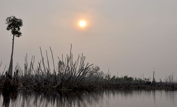
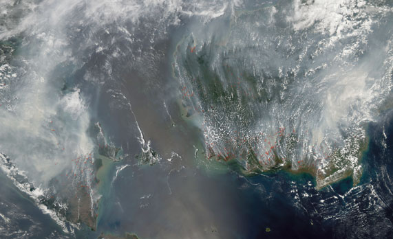
Smoke and particulates from last summer’s Indonesian peat swamp fires on the island of Borneo drifted across neighboring Singapore and Malaysia. The smoky haze set pollution records that threatened public health in mid-June.
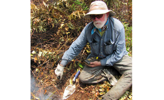
Deforestation from an ill-fated plan to convert nearly 2.5 million acres of Kalimantan peat swamp forest into rice paddies has contributed to Indonesia becoming the third-largest emitter of carbon, according to professor Mark Cochrane, a senior scientist at the Geographic Information Science Center of Excellence.
Over the last 12 years, Indonesia had the largest increase in forest loss of any nation, according to a study published in the November issue of Science magazine. Although Indonesian government agencies are working to reduce the number of fires, dealing with this altered topography is challenging.
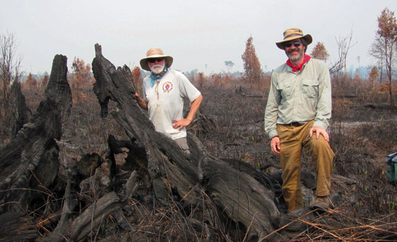
Through a three-year, $2.2 million grant from NASA, Cochrane will use satellite imaging, field studies and modeling to help the Indonesian Forest Research and Development Agency assess the progress being made to reduce carbon emissions from Borneo’s ancient peat swamp forest.
He collaborates with carbon emissions expert Robert Yokelson, a chemistry professor from the University of Montana. The grant is part of NASA’s global carbon monitoring program, which is part of an international focus on reducing emissions due to deforestation.
Struggling to breathe
Though the Indonesian president issued an apology this summer, his neighbors are growing impatient.
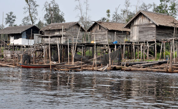
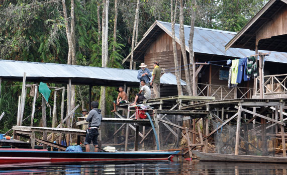
“The smoke makes your eyes watery and red,†said Melvin Lee, a native of Malaysia and recent SDSU graduate. He spent last summer with his parents, who live on the northwestern side of Borneo.
The sky was hazy when he arrived in early June, but got worse—the worst it’s ever been, according to an article in the Indian Express.
“You can’t even breathe,†said his sister Rachel. She and her brother graduated from the SDSU civil engineering program in December.
The seasonal haze, which began 10 to 12 years ago, lasts about a month and a half, Michael estimated. When the engineering students were children, Rachel recalled “we were happy because we didn’t have to go to school.â€
But that thrill has worn off as their countrymen struggle to cope. People are advised to stay inside, but the smell of burning vegetation creeps into buildings through air conditioning systems. Residents rush to purchase protective face masks, but there aren’t enough. Priority is given to the elderly and those with respiratory ailments.
“We treat it as a natural disaster, but it happens every year,†said Melvin. “It affects the whole continent of Southeast Asia.â€
Creating disastrous situation
The Mega Rice Project, which began in 1996, sought to raise enough rice to feed the Indonesian population. Former Indonesian President Suharto authorized construction of nearly 2,900 miles of channels to drain the peat swamps and then loggers cleared the trees.
The peat forest soils consist of large accumulations of dead organic matter, some tens of thousands of years old, more than 20 feet deep, Cochrane explained. Under normal circumstances, these water-logged, oxygen-starved peat domes don’t decay or burn.
When the land is drained, the organic matter compacts, decays and releases carbon, Cochrane added. “It’s like a block of ice evaporating in your refrigerator.â€
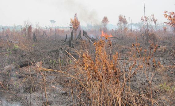
Once the logging companies completed their work, the indigenous people and a host of new settlers were left to figure out how to survive in this altered environment. That can mean burning to clear the peat surface for hunting, fishing and subsistence-level farming.
Unfortunately, the soil beneath the peat does not contain the minerals needed to support crops, Cochrane explained. “It was a giant catastrophe.â€
Releasing carbon
Fires accelerate the oxidation process and, especially during dry years, the cleared areas experience many uncontrolled fires, according to Cochrane, who has studied wildfires for more than 20 years. A German research team estimated that the 1997 peat and forest fires during El Niño released between 0.87 and 2.57 billion tons of carbon into the atmosphere.
Smoldering peat fires slowly burn thin layers of the organic matter but can only be extinguished when the land floods, Cochrane explained. Peat fires eat into the ground surface and release huge amounts of carbon, much more than typical forest fires do.
These peat fires can last for weeks or months, creating the thick smoke and suspended particulates that are carried to neighboring countries. He estimates that the peat contains 20 times as much carbon as the forest trees themselves did.
Despite Indonesian government efforts to control the fires, many can only be extinguished during the rainy season. As part of his research, Cochrane hopes to figure out which fires are most likely to result in peat fires.
Quantifying reduced emissions
An international program called reduced emission through deforestation and degradation, or REDD, offers monetary rewards to countries that reduce their carbon emissions, according to Cochrane. Another program, REDD Plus, takes this one step further, making sure that the funds go to support the livelihoods of the people in the region, such as developing a sustainable logging system.
However, progress in carbon sequestration must be documented by a third party, he explained. That’s the challenge: “What does it take to credibly show that you’ve done something?â€
The basic idea is simple, Cochrane said, but “the devil is in the details.â€
As a first step, Cochrane and his colleagues analyzed satellite imaging of land cover as far back as 1993 to document when the forest was cleared and the land drained. But areas of forest that are simply thinned are harder to track, he explained.
To get a better read on the vegetation and hydrology, the researcher uses light detecting and ranging, commonly called LIDAR. The laser mapping technique gathers remote sensing data via an airplane. Nearly $20 million has been put into field data collection by the Australian government in recent years.
The initial dataset was collected in 2007 and a second in 2011. Looking at specific points that had surface fires, Cochrane can surmise that those areas that have gotten lower had peat soil losses as well due to subsurface fires.
Using these comparisons, Cochrane is developing a model to predict how much peat will be burned based on the given conditions.
A third set of LIDAR data will be acquired in 2014. Comparison with the 2011 data will then allow Cochrane to adjust the statistical model. The goal is to develop a monitoring tool which will allow a third party to reliably estimate how much carbon is being lost and subsequently how that number has decreased over time, he explained.
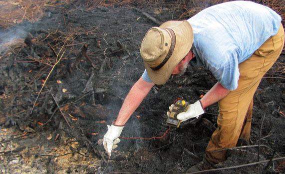
Up to 200 different gases may be escaping through these fires, but no method currently exists to accurately determine the composition of peat fire emissions. In the past, researchers have estimated emissions by hacking out a block of peat and analyzing it in the lab, but Cochrane pointed out, “that’s not the way things burn in the field.â€
Next year, Yokelson will take lab equipment into the field to monitor the emissions from the peat fires. Cochrane said they’ll then be able to get “the best data for peat fire emissions anywhere in the world.â€
With the tools these researchers develop, the Indonesian government may be able to qualify for international support that can help the nation further reduce its carbon footprint.
Christie Delfanian


